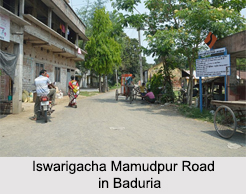
 Baduria is a city as well as a municipality located in the North 24 Parganas district in the state of West Bengal in India. It is a part of the Basirhat subdivision and also has a police station. The town of Baduria is located at 22.74 ° North and 88.79 ° East. This town is situated at an altitude of 8 meters above sea level. State Highway 3 passes through Baduria.
Demographics of Baduria
In accordance with the 2001 India census, Baduria had a population of 47,418. Males and females respectively comprise 51% and 49% of the population. The standard literacy rate of this town is 67%, higher than the national average rate of 59.5%. 55% of the male population and 45% of the female population are literate. 13% of the population is less than 6 years of age.
Academics in Baduria
Some of the popular institutions of this town are Baduria Dilip Kumar Memorial Institution (co-educational), Baduria L.M.S. High School (co-educational) and Baduria L.M.S. Girls High School (girls only). These three are higher secondary institutions.
Medical Services
Rudrapur Rural Hospital serves as the main medical facility in Baduria CD Block. There are primary health centers at Dakshin Chatra, Jadurhati, and Model Belghoria in Baduria.
This article is a stub. You can enrich by adding more information to it. Send your Write Up to content@indianetzone.com


