 Lakhisarai District is an administrative district of Bihar. Lakhisarai town is the district headquarters. This district covers an area of about 129397 hectares and lies between 25 degree to 25 degree 20 minutes north latitude and 85 degree 55 minutes to 86 degree 25 minutes east longitude. Lakhisarai District is bounded by Munger, Sheikhpura District, Begusarai and Patna in the east, south, west and north respectively.
Lakhisarai District
Lakhisarai District in Bihar has its headquarters located at Lakhisarai town. This administrative district of Bihar Lakhisarai District is one of the best trading centres in Bihar.
Introduction
Lakhisarai District is an administrative district of Bihar. Lakhisarai town is the district headquarters. This district covers an area of about 129397 hectares and lies between 25 degree to 25 degree 20 minutes north latitude and 85 degree 55 minutes to 86 degree 25 minutes east longitude. Lakhisarai District is bounded by Munger, Sheikhpura District, Begusarai and Patna in the east, south, west and north respectively.History of Lakhisarai District
 Lakhisarai was an established administrative and religious centre during the golden period of Pala dynasty. This region of Lakhisarai District was identified in old times as a place of rocks, mountains and statues of different Hindu and Bhuddhist gods and goddesses. Even in Buddhist literature, this place had been mentioned as "Anguttri" meaning thereby a district status. This beautiful place, naming Lakhisarai came into existence, as a new district from Munger. Hence, this place in the ancient period also can be identified with the name of Munger or Anga Pradesh. Lakhisarai region during Pal administration was the capital of Pals for some period. Other evidences found in the district under the Pala king Dharampala.
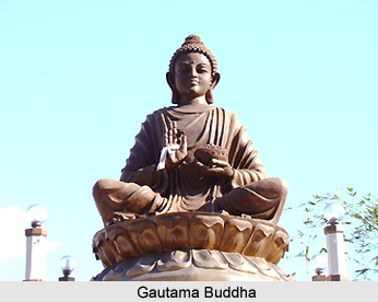
Noted Historian Dr. D.C. Sarkar during his visit, found some more evidences based on which, he also confirmed that this place was very important. The Chinese traveller Huen Tsang described this place having 10 Buddha mathas and more than four hundred Buddhists resided here. Most of the Buddhists living here were Hinayanas . There were 10 temples also of Hindus and people lived here with peace and harmony. People of that time used to live in a much-planned manner. According to historian Sri Radha Krishna Chaudhary all, the Buddha mathas were situated in southern side of Ganga and the king of Pal Bans was also a Buddhist. The administrator of Pal dynasty ruled over this region of Lakhisarai in seventh century to eleventh century. Sen dynasty also ruled this region for some period in 11th century. The people believe that Krimila of that period is now Kiul Basti, which is situated in Southern side of Lakhisarai Railways station. Krimila was a centre of Buddhist religion. Lord Buddha also stayed here for three years on Chaliya Mountain and Jantugram was nearby Chliya Mountain and was situated on bank of river Krimikala, where Lord Buddha with his followers used to visit and deliver speech.
History indicates also that Md. Bin Bakhtiyar attacked this region in 11th century. Sher Shah Suri also ruled this region in the 15th century. Surrajgarha witnessed Great War of Shershah and Mugal emperor Humayun in 1534. Also in 1953, a fight occurred in Fatehpur near Surajgarha between Miya Suleman and Adlshah in which Adilshah was killed.
In religious context, Surajgarha was also an important place for Shaivam sect. One beautiful Shiva Mandir was there and large number of people gathered there for worship of Lord Shiva with religious devotion.
Geography of Lakhisarai District
Geographically, the district can be divided into three parts - Hilly area, Flood hit area and Plain area. The hilly area comprises hill series and rocks like Kachhua hills, Kajra Mountains, Abhaipur and Jaynagar Mountains including forest area. Almost whole of Pipariya block and some part of Barahiya is considered as flood hit area. This area remains almost drowned in rainy season. However, so far as cultivation and agriculture is concerned this area is called the stock of food grains. Rest of the part is plain area with full greenery and cultivable land.
The climate of Lakhisarai District is extreme in nature; it is quite hot during the summer and cold during the winter. January is the coldest month when the mean minimum temperature comes down to approximately 4 degree Celsius. The temperature starts rising from March and reaches its peak in May when the mercury touches about 45 degree Celsius. Rain starts sometime in mid June and lasts till mid September. Maximum rains occur during the months of July and August (289 mm). Ganga River, Kiul and Harohar are the main three rivers flowing through the district. The alluvial plain extending up to the foothills of Lakhisarai ranges is extensively cultivated. Rice, wheat, pulses are the chief crops and the area is dotted with bamboo clumps and mango orchards. Planned irrigational facilities within the district are not sufficient. Top quality of sands and stones are found in this district.
The climate of Lakhisarai District is extreme in nature; it is quite hot during the summer and cold during the winter. January is the coldest month when the mean minimum temperature comes down to approximately 4 degree Celsius. The temperature starts rising from March and reaches its peak in May when the mercury touches about 45 degree Celsius. Rain starts sometime in mid June and lasts till mid September. Maximum rains occur during the months of July and August (289 mm). Ganga River, Kiul and Harohar are the main three rivers flowing through the district. The alluvial plain extending up to the foothills of Lakhisarai ranges is extensively cultivated. Rice, wheat, pulses are the chief crops and the area is dotted with bamboo clumps and mango orchards. Planned irrigational facilities within the district are not sufficient. Top quality of sands and stones are found in this district.
Tourism in Lakhisarai District
 Tourism in Lakhisarai District means a memorable and enriching experience for the travellers. It offers visits to several places of religious and historical importance. The tourism spots of Lakhisarai District attract people from different parts of the country.
Some of the popular attractions of Lakhisarai District are mentioned below -
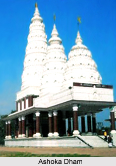
Rajauna: Rajauna is a village within the municipal area of Lakhisarai and is about four kms from Lakhisarai headquarters. This place was the capital of Indradaman, who was the last emperor of Pala dynasty. Historical ruins prove that Rajauna had a glorious past. Ashok dham is also situated nearby Rajauna village. Ashok Dham is known for unique Shivling made of black stone, which is huge in size.
Kabaiya: Kabaiya is a ward within Lakhisarai Municipality near Janagar Hills. Historians based on materials found in Kabaiya, said that this place was significant in ancient time in period between ninth and tenth century.
Nongarh: Nongarh is about 10 kms from Lakhisarai and is situated within Ramgarh Chowk Block. During excavation of Nongarh, statue of god and goddesses made of sand stone and some stoops were found which indicate that this place was also important in terms of a glorious centre of civilization and culture in ancient times.
Barahiya: Barahiya is a small town situated at 15 kms north to Lakhisarai. Temple of Tripura Sundari Man Bagwati popularly known as Maharani Asthan, which is the highest temple of Bihar is situated here. Barahiya is also considered important for having north flowing Ganga River and people take holy dip in it. According to beliefs, cremation on the bank of north flowing Ganga brings Moksha to the people.
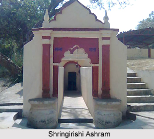
Shringirishi: Shringirishi is a beautiful natural place, having a beautiful temple of Lord Shiva on mountain near Jalappa Asthan. It is considered as an important religious place. Shringirishi is a beautiful place with a soft water spring and full of greenery and rocks, making this place memorable. On Shivaratri and Makar Sankranti large gathering is seen here. Shringirishi dam is located nearby the temple with full of blue water. Boating in the dam is a good experience and makes the visit to this place a memorable one.
Abhainath Asthan: Abhinath Asthan is a beautiful place on the top of the mountain of Abhaipur. There is a temple of a popular saint called Abhainath Baba. Name of the Abhaipur village as well as Abhaipur Railway station is named after the name of Abhainath Baba. It is said that Abhainath Baba always protected the people of this region from all the dangers and diseases. People have great faith in Baba. Amrasani is a beautiful picnic spot, near Abhainath Asthan. At Amrasani there is a beautiful soft water spring, mountains and rocks and forest with full greenery. On 1st of January and 14th of January large number of people come, enjoy this place, and take bath in this spring. People can see the stream of water spring flowing for very short distance then it disappears magically.
Bhagwati Asthan: Bhagwati Asthan of Abhaipur is an important temple of Maa Bhagwati situated at the foot hill of Abhaipur village mountain. On the eve of Nag Panchami a large number of people come here to offer prayers.
There are some other places in this district, which are significant or were known for its significance in ancient period, in historical, archaeological or in religious context. These tourism attractions offered by Lakhisarai District are worth visiting.
Recently updated articles in States of India
History of Thissur District
Early History of Thissur District explains flourishing of the port cities. Now these port cities are transformed into archaeological sites.
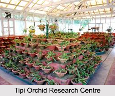
Tippi Orchid Research Centre, Arunachal Pradesh
Tippi Orchid Research Centre in Arunachal Pradesh is renowned for its rich collection of exotic and endangered orchids. Surrounded by lush rainforest...
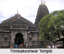
Tourism in Nashik District
Pilgrimage tourism in Nashik district involves visiting the various places of Hindu and Jain worship located here. Some of the holiest sites for Hind...
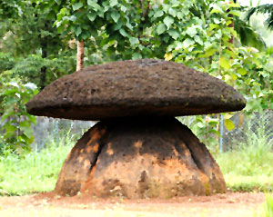
Mangadu, Kerala
Mangadu in Kerala’s Kollam district is a significant megalithic site known for its urn burials, cist burials, menhirs, and stone circles. Excavations...
Devaswom
History of Devaswom is not very ancient and can be dated back to late seventeenth century.
Related articles in States of India

East Indian States
East Indian States comprises of Bihar, Jharkhand, West Bengal, Odisha and also the Union Territory of Andaman and Nicobar Islands. It defines the cult...

Purnia District in Bihar
Purnia District is located in Bihar and extends from River Ganga to Nepal. The district has a rich Hindu history and glorious past.

Hooghly district
Hooghly District along the bank of the river Hooghly is one of the principal trading ports of West Bengal.

Geography Of Chittoor District
Geography of Chittoor district is spread along the topography of the land which is divided into two natural divisions; Chittoor has a dry and healthy...

Districts of West Bihar
Districts of West Bihar is comprised of medieval monuments that were built by the different governors of Mughal era.