


 After the origin of Brahmaputra River in southwestern Tibet as the Yarlung Tsangpo River, it flows across southern Tibet to penetrate through the Himalayas in great canyons and into Arunachal Pradesh where it is known as Dihang River. The Brahmaputra River flows southwest through the Assam Valley as Brahmaputra and south through Bangladesh as the Jamuna. There it gets together with the Ganga to form an enormous delta. The river is almost 1,800 mi (2,900 km) in length and is an important source for irrigation and transportation. Its upper course was long unknown, and its identity with the Yarlung Tsangpo was only established by discovery in 1884-86. This river is often called Tsangpo-Brahmaputra River. In Bangladesh the river flows together with the Ganga and splits into two the Hugli and Padma River. When it merges with the Ganges it forms the world's largest delta, called the Sunderbans. The Sunderbans is best known for its tigers and mangroves. This river has a rare male name that means "son of Brahma" in Sanskrit. After the origin of Brahmaputra River in southwestern Tibet as the Yarlung Tsangpo River, it flows across southern Tibet to penetrate through the Himalayas in great canyons and into Arunachal Pradesh where it is known as Dihang River. The Brahmaputra River flows southwest through the Assam Valley as Brahmaputra and south through Bangladesh as the Jamuna. There it gets together with the Ganga to form an enormous delta. The river is almost 1,800 mi (2,900 km) in length and is an important source for irrigation and transportation. Its upper course was long unknown, and its identity with the Yarlung Tsangpo was only established by discovery in 1884-86. This river is often called Tsangpo-Brahmaputra River. In Bangladesh the river flows together with the Ganga and splits into two the Hugli and Padma River. When it merges with the Ganges it forms the world's largest delta, called the Sunderbans. The Sunderbans is best known for its tigers and mangroves. This river has a rare male name that means "son of Brahma" in Sanskrit.
The Brahmaputra is navigable for most of its length because of its favorable geological properties. The lower part of this river is sacred to Hindus. The river is prone to disastrous flooding in spring when the Himalayan snows melt. It is also one of the few rivers in the world that is prone to tides. Late Quaternary sediments of the Brahmaputra basin bear a history of river switching, climate change as revealed from sand- and clay-size mineralogy of boreholes, and modern riverbed grabs. Epidote to garnet ratios in sand fraction sediments is diagnostic of source with high E/G that indicates Brahmaputra origin and low E/G indicates Ganges prominence. The Brahmaputra contains kaolinite (29%), illite (63%), and chlorite (3%). The analysis of mineralogic and stratigraphic data of Brahmaputra basin indicates that the Ganges and Brahmaputra rivers have changed position several times during the Holocene. Extended periods of mixed river inputs seem to be out-of-the-way to the Early Holocene, indicating quick migrating and meandering channels during sea level low stand. Tectonically shifted accommodation in the Sylhet Basin may have contributed to the superior easterly course of the Brahmaputra during much of the Holocene. The abundances of illite and chlorite as in comparison to smectite and kaolinite suggest varied degrees of physical and chemical weathering. High IC values in early post-glacial deposits in the Brahmaputra river course, suggest a dominance of physical weathering during that time. Enhanced chemical weathering under increasingly warmer and more humid conditions are also due to various geological changes in the basin. Weathering patterns in the catchment respond quickly to climatic shifts has similar reasons. |
| |||


Home > Reference > Geography of India > Natural Resources of India > Water Resources in India > Indian Rivers > Inland Drainage Basin Rivers > Brahmaputra River > Geology of Brahmaputra River
Geology of Brahmaputra River
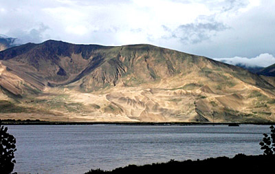
| The geology of River Brahmaputra suggests the fertile alluvial plains of the basin. |
| ||||||||||||||||||||||||||||

