Geography of Brahmaputra River
|
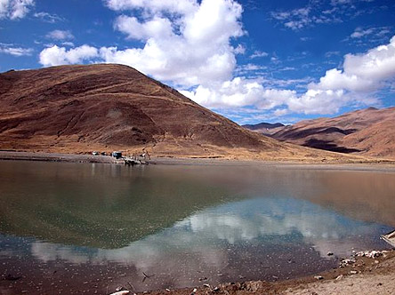
The geography of Brahmaputra River indicate extensive flood plains and fresh alluvium deposits.
|
|
|
 The Brahmaputra River is one of the major rivers in Eastern India. During the monsoon season or the months of June-October, floods seem to be a common occurrence in the geographical area of Brahmaputra River. Deforestation in the Brahmaputra watershed has resulted in increased siltation levels that result in flash floods, and soil erosion in critical downstream habitat, such as the Kaziranga National Park in middle Assam. Occasionally, massive flooding causes huge losses to crops, life and property. Periodic flooding is a natural phenomenon that is economically important because it helps to maintain the lowland grasslands and associated wildlife. Periodic floods also deposit fresh alluvium refilling the fertile soil of the Brahmaputra River Valley. Thus flooding, agriculture and agricultural practices are closely connected. The Brahmaputra River is one of the major rivers in Eastern India. During the monsoon season or the months of June-October, floods seem to be a common occurrence in the geographical area of Brahmaputra River. Deforestation in the Brahmaputra watershed has resulted in increased siltation levels that result in flash floods, and soil erosion in critical downstream habitat, such as the Kaziranga National Park in middle Assam. Occasionally, massive flooding causes huge losses to crops, life and property. Periodic flooding is a natural phenomenon that is economically important because it helps to maintain the lowland grasslands and associated wildlife. Periodic floods also deposit fresh alluvium refilling the fertile soil of the Brahmaputra River Valley. Thus flooding, agriculture and agricultural practices are closely connected.
The Indo-Gangetic Plains along the Brahmaputra River are large floodplains of the Indus and the Ganga-Brahmaputra river systems. They run parallel to the Himalayan mountain ranges and extend from the Jammu and Kashmir in the northwest to Assam in the east. Some of the main rivers like Ganga and Indus are an integral part of Indian geography. The Geography of India extends from the Deccan Plateau and is a part of the Central Highlands, which comprises, besides Deccan Plateau, in the south, Malwa Plateau, in the west, and Chota Nagpur Plateau in the east. The fertile plain of Brahmaputra is a flat plateau covering vast acres of land with elevations ranging from 300 to 600 m. It is bounded by mountain ranges to the north and flanked by other vegetations.
Brahmaputra River one of the largest rivers in the world and its basin covers areas in Tibet, China, India and Bangladesh. It originates in the Chemayung-Dung glacier, approximately at the location of 31°30´N and 82°0´E, some 145 km from Parkha, an important trade centre between lake Manasarowar and Mount Kailas. It has a long course through the dry and flat region of southern Tibet before and then it breaks through the Himalayas near the Namcha Barwa peak at about 7,755m. Its main tributaries in India are the Amochu, Sankosh, Dibang, Raidak, Bhareli, Mans and Luhit. The several tributaries in Tibet are resulting partly from a low range between the main Himalayas and the Tsang-po. The total length of the river from its source in southwestern Tibet to the mouth in the Bay of Bengal is around 2,850 km, including the Padma and Meghna rivers up to the mouth. Within Bangladesh territory, Brahmaputra-Jamuna is 276 km Long River, of which Brahmaputra is only 69 km.
|
|
|
|


