 Geography of Golaghat District mainly includes huge area and a pleasant sub-tropical climate reflecting the scenic beauty of the region. The total area of this district is near about 3502 sq kms and it lies 100 meter above the mean sea level. Golaghat District is surrounded in the north by Brahmaputra River; in the south by Nagaland; in the east by Jorhat and in the west by Karbi Anglong and Nagaon districts. It is strategically positioned between 26 degrees to 27.1 degrees latitudes and 93 degrees to 94.18 degrees longitudes.
Geography of Golaghat District also comprises several rivers that are flowing through the region. Dhansiri is the chief river of this district, which originates from `Laisang peak` of Nagaland. It flows through a distance of 352 km from south to north before joining Brahmaputra River. Its catchments area is 1220 sq kms. Doyang, Nambor, Doigrung and Kalioni are the main four streams of Dhansiri River. Doyang joins with Dhansiri River at the south point of Golaghat town. The other rivulets of this main river of the region originate from Karbi-Anglong and flow in the west to east direction. The river Kakodonga marks the border of Golaghat and Jorhat districts. It also originates in Nagaland and flows in the south-north direction.
The climate of Golaghat District is tropical with a hot and humid weather existing in most of the summer and monsoon months. The average annual rainfall of this region is 1300 mm. Maximum rainfall occurs in the months of June and July. The maximum temperature of the district is 38 degree Celsius in June and minimum temperature is 10 degree Celsius in the month of December. Wind direction is from northwest to southeast. Further, the vast geography of Golaghat District also includes tropical evergreen and semi evergreen forest; tropical grassland in Kaziranga National Park and swampy vegetation.
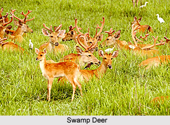
The flora and fauna of Golaghat District are rich and diverse. Nambor Reserve Forest is very rich in plant diversity. Rare and endangered plant species are found in this forest. Further, the fauna of this region is rare and varied too. Besides the one horned Rhino, Swamp Deer, Water Buffalo and Indian Elephant of Kaziranga National Park, Golaghat District harbours various other endangered wildlife such as Turtle and Tortoise, Butterflies, Honeybee, Great Indian Hornbill, Bengal Florican, White wing Wood Duck, Hoolak Gibbon, Pigtail Macaque, Slow loris, Chinese Pangolin, and much more. Thus, it can be said that the geography of Golaghat District is subjugated by huge range of tropical forests comprising endangered species.


