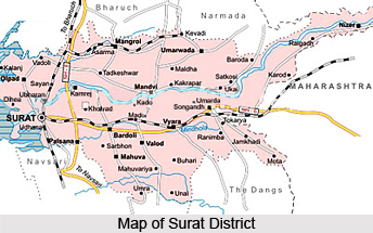
 Surat District is located in the southern part of Gujarat. Surat district has its headquarters at Surat. The district of Surat is divided into ten revenue talukas. Choryasi, Palsana, Kamrez, Bardoli, Olpad, Mangrol, Mandvi and Surat city are the major developed talukas in the district. Surat is chiefly known for its textiles and diamond processing industries. The district is promising as a potential hub sector in Gujarat. The total area of the district is 7,761 sq km.
Geography of Surat District
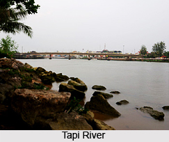
Geographical location of Surat District is 21.0 degree to 21.23 degree North (Latitude) and 72.38 degree to 74.23 degree East (Longitude). Maximum temperature of the district is 10 degree Centigrade and the minimum temperature is 45 degree centigrade. The main river in the district is Tapi River and the average rainfall in the place is 1000-1200 mm.
Demography of Surat District
According to the Popluation Census in the year 2011, Surat District had population of 6,081,322 of which male and female were 3,402,224 and 2,679,098 respectively. In 2001 census, Surat had a population of 4,275,540 of which males were 2,362,072 and remaining 1,913,468 were females. Surat District population constituted 10.06 percent of total Maharashtra population. The average literacy rate of Surat District in 2011 was 85.53 compared to 77.62 of 2001.
 Education in Surat District
There are around 2587 primary and 542 secondary and higher secondary schools in Surat District. Surat district has many Medical, nursing, Ayurvedic and physiotherapy colleges. Technical colleges offering courses in information technology, electrical, electronic and communication, chemical, civil, production and mechanical engineering are also present in the district. Institutes offering specialised courses in gems and jewellery and textile sector are also extensively available to supply trained manpower for the industry. Man Made Textile Research Association (MANTRA) has been set up to carry out technical service activities to the man-made fiber textiles industry.
Economy of Surat District
Economic development in Surat district could be attributed to the presence of a large number of diamond processing, textiles and chemical and petrochemical industries. Surat has been very successful in attracting a sizeable amount of Foreign Direct Investment (FDI) in various sectors like energy, oil, and petroleum. There are around 605 medium and large scale industries based in Surat district. There are over 41,300 small scale industries (SSI) running in Surat district. Some of the main industries under SSIs in Surat are textiles, chemicals dying and printing, diamond processing, and. engineering and related activities.
 Tourism in Surat District
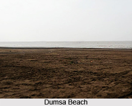
Surat district has various tourist destinations. It houses delicately carved mosques, Parsi agiaris and European tombs. Famous Dumas beach is only 18 Km away from Surat City. Hazira beach is situated 28 Km from Surat is fringed by feathery `Casurina` trees and has a comfortable holiday home for visitors. Some of the well-known tourist destinations in Surat are Surat Castle, Mughalsarai, Sardar Vallabhbhai Patel Museum, Planetarium and the European tombs. Swaraj Ashram at Bardoli, Historical fort at Songadh, Aquatic Water Park at Kamrej, Water Fun Park on Hazira Road, and Joy n Joy Amusement Park at Dhonapadi on NH-8 are some of the nearby tourist spots from the district.
How to reach Surat District
By Road:
Surat district is well connected to various locations through national and state highways. NH-8 connects Surat with Mumbai (307 km), Delhi (1,034 km), Kolkata (1676 km), Chennai (1,371km) and Hyderabad (824km).
By Rail:
Almost all the talukas of Surat are well connected with the rail network. Surat is well connected with Valsad, Vapi and Mumbai towards its south and with Bharuch, Vadodara and Ahmedabad in the north.
By Air:
Surat has a domestic airport which is well connected to different metros. It has daily flights to Delhi, Jaipur, and Ahmedabad. Nearest airports are at Vadodara and Mumbai.
By Port:
Magdalla and Hazira Ports in Surat have good rail and road connectivity. Magdalla port is 2 Km away from the state highway and 15 Km away from NH-8. Hazira Port in Surat has close proximity to the high speed dual carriageway which is under construction. The port is well connected with main Mumbai - Ahmedabad - Delhi broad gauge railway line.


