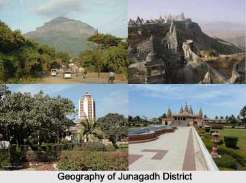
 Junagadh district is located in western Gujarat. The district is divided into 14 talukas of which major ones include, Veraval, Junagadh, Kodinar, Manavadar, and Mangrol. The total area of the district is 8,846 sq. km. As per 2001 census, the population of Junagadh district is 24, 48,173 with population density of 277 persons per sq. km. The district headquarter is at Junagadh. Junagadh is famous for the Gir National Park, the only abode to Asiatic lions and mountain range Girnar is a major pilgrimage destination.
Geography of Junagadh District
Geographical location of Junagadh district is 20.44 degree to 21.40 degree North (Latitude) and 69.40 degree to 71.05 degree East (Longitude). The maximum temperature of this place is 42 degree centigrade and the minimum temperature is 10 degree centigrade. There are six main rivers which flow through the district, which are Ojhat, Uben, Hiran, Raval, Madhuvanti and Machhundri. The average rainfall of Junagadh district is 787 mm.
Education in Junagadh District
Junagadh district has 1296 Primary schools, and 475 secondary and higher secondary schools. Junagadh Agricultural University offers education in agriculture, agriculture engineering and fisheries. Technical colleges offering courses in information technology, chemical, civil, electrical, and electronic and communication, production and mechanical engineering are also present in the district. Junagadh also has a Fisheries College located in Veraval taluka offering courses in Pisciculture.
Economy of Junagadh District
Agriculture is the backbone of the district economy. 70 percent of the population is engaged in primary sector, 22 percent in secondary sector and 8 percent in tertiary sector. Fish processing industry is a major sector in Junagadh. Presence of huge reserves of Limestone makes the cement industry a thriving industry sector in the district. Agriculture based industries like edible oil, groundnut units, solvent plants and oil cakes and Marine based industries like fish processing units and frozen fish are most popular in Junagadh.
Tourism in Junagadh district
Junagadh district has many places of interest in and around its geographical premises. Gir National Park is the major attraction for most visitors to Junagadh district. The Asiatic Lion is the key feature of the park. In addition to the lion, there are jungle cats, jackals, spotted deer, hyenas, blackbuck, porcupines and leopards. Mount Girnar is the highest point of elevation in Gujarat. Kutiyana is a pilgrimage site of Muslims. The town is flocked with tourists during Pir Minskinsha Urs, held from 13th through 15th day in the Muslim month of Sabaan.
How to reach Junagadh District
By Road:
National Highway 8D passes through the district and connects Junagadh and Rajkot. With a length of 96 km, National Highway 8E passes through the district connecting it to Bhavnagar and Amreli district. The district is also connected to Jamnagar and Porbandar through NH 8E (Ext.), with a total length of 43 km.
By Rail:
Junagadh district has Junagadh-Veraval and Veraval-Somnath railway lines present. Junagadh is connected to Ahmedabad and Rajkot cities through rail.
By Air:
The district has a domestic airport located at Keshod connecting it to Porbandar and Mumbai.
By Port:
Veraval port is in Junagadh has good road and rail connectivity. The port is connected with Ahmedabad by road and broad gauge railway line.


