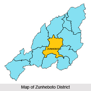
 Zunheboto District is situated in the heart of Nagaland and is bounded by Mokokchung District in the east and Wokha District in the west. Zunheboto District derived its name from two sets of words `Zunhebo` and `To` in Sumi dialect. `Zunhebo` is the name of a flowering shrub with white leaves which bear sponge like ears containing sweet juice and `To` means the top of a hill. Zunheboto Town is the only designated urban area of the district and it is also the district headquarter. Zunheboto District covers a total area of 1255 sq kms.
Geography of Zunheboto District
Geography of Zunheboto District is spread over high hills. The hills vary from 1000 to 2500 metres. The altitude of the district headquarters is 1874.22 metres above the sea level. Owing to the high altitude, this district enjoys a monsoon climate throughout the year. Winters are very cold but summers moderately warm. December and January form the coldest part of the season and at times the temperature comes down to10 degree Celsius. The average rainfall is about 200 cm. In Zunheboto District mainly alluvial soil, forest soil (organic), non-laterite soil and soils of high altitudes are found.
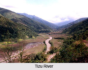 There are three important rivers in the district, namely Tizu River originating in Tuensang District flows down towards south crossing at the centre of Zunheboto District and join Chindwin. Doyang River originating in Japfu passes through west part of the district and joins Dhansiri in Assam. Tsutha River, originating in North East of Zunheboto drains eastern part of the district and joins Tizu below Nihoshe village, where a Mini Hydel Power project is located.
Demography of Zunheboto District
Total Population of Zunheboto District is 154909 according to 2001 Census. Most of the population resides in rural areas. Zunheboto District is the home of the Sumis. Sumis are considered to be the Martial tribe among the Nagas. They are famous for their colourful war dances and folk songs. They have their colourful dance and songs. Their ceremonial war dresses are worth seeing. Tuluni is one of the most important festivals. It is observed in the second week of July every year.
Economy of Zunheboto District is based on agriculture. The people here practice shifting cultivation. However, those living on the bank of Tizu River practice terrace cultivation. Satoi and Asuto areas are considered as less developed areas of the district. There are several villages in the district that are not yet properly connected.


