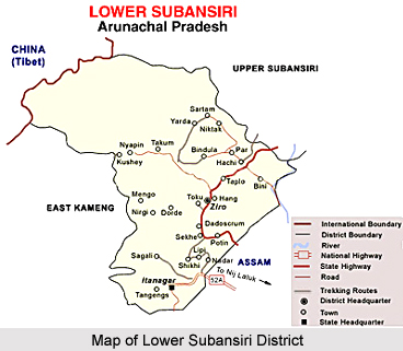
 Geography of Lower Subansiri District in Arunachal Pradesh comprises approximately an area of almost 10,135 Sq. kms. The entire landscape of the Lower Subansiri district is mostly mountainous landscape, and here the hill ranges varies roughly from 1000 to 1600 metres above the sea level. A larger part of this district falls within the higher mountain zone including twisted peaks and numerous valleys. This district has a magnificent plateau at around 1564 metres above the sea level, where Ziro, the district headquarter is situated.
Moreover, the geography of Lower Subansiri District also consists of numerous forests, which are rich with precious species of trees and diverse varieties of herbs and shrubs; here cane and bamboo grow plenty. Further, some superb floral resources of wilder species are often found in the shadowy recesses of the forests of this district. Interestingly, the forests of this beautiful district of Arunachal Pradesh have got huge economic value. The Lower Subansiri District is also enriched with varieties of wild fauna such as Royal Bengal Tigers, leopard, cats, bear, panthers, boars, antelopes and barking deer and more. River Kamala is one of the main rivers of this district of Arunachal Pradesh. The origin of this river is from the snow ranges of China that flows towards South-East and meets the Subansiri River at Raga Circle. The Subansiri River that was once famous for its gold dust flows through the Lower Subansiri District. Finally, this river joins the Brahmaputra River in plain of Assam. The physiographic territory of the Lower Subansiri district also includes several rivers such as Khru, Panior, Kime, Panya, Selu, Pugo, Persen, Rein Sipu, Pange, Kiile etc. which are also worth mentioning.
This article is a stub. You can enrich by adding more information to it. Send your Write Up to content@indianetzone.com


