 Bihar is located in the eastern region of India in the south Gangetic plain and is the most fertile region in India. It is rich in mineral deposits like iron, coal, bauxite and uranium. The state is also one of the largest producer of fruit and the second largest producer of vegetables. The State of Bihar is divided into 38 districts. The districts have been detailed below:
Araria District
The backbone of this district is the jute mills along with the cultivation of crops like paddy, maize, and jute. It is known to be the natural habitat of the Gangetic dolphin.
Aurangabad District
It is famous for the woolen carpets and blanket weaving with Aurangabad as its headquarters.
Begusarai District
The economy of this district of Bihar depends on industry and agriculture. Begusarai is the headquarter of this district.
Banka District
It covers an area of 3,019 sq. km. and it produces crops like paddy, wheat, maize and lentils.
Bhojpur District
It is one of the 38 districts of Bihar with Arrah as its headquarters.
East Champaran District
It is an important district of Bihar with its headquarters at Motihari.
Gopalganj District
It is spread over an area of 2,033 sq. km and is significant because of the flourishing cottage industries like weaving, woodwork, potteries and bamboo work.
Jamui District
The topography of this district is marked by hills and plains and occupies an area of 3,122 sq. km. with Jamui as its headquarters.
 Gaya District
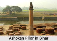
Among all the districts of Bihar, it is famous for Bodhgaya an important pilgrimage site of Buddhism.
Darbhanga District
This is one of the important districts of Bihar, which produces crops like sugarcane, wheat, rice in huge quantities.
Buxar District
It is poplar for producing important crops in huge amount. Buxar is the headquarters of this district.
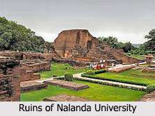
Nalanda District
It is one of the popular districts of Bihar known for its rich history and Bihar Sharif is the headquarters of it.
Patna Districts
Patna is the headquarters of this district. It is also one of the important districts of Bihar.
Jehanabad District
Jehanabad is the headquarters of this district; it is drained by the Phalgu River.
Kaimur District
The main attractions of it are the Kaimur hills and the Kaimur Wildlife Sanctuary which are ideal tourist destinations.
Katihar District
The main rivers traversing Katihar, one of the 38 districts of Bihar, are the Mahananda River and the Ganga River.
Khagaria District
It is one of the important districts of Bihar with its headquarters at Khagaria.
Kishanganj District
It is the religious destination of devotees of all faiths. The different places of worship are Maa Kali Mandir, Odraghat, Masjid, Sri Digambar Jain Mandir, Gurdwara Guru Singh Sabha Catholic Church and Mazare Kadam Rasool.
Lakhisarai District
The climate and the land of this district are favourable for the cultivation of crops like wheat, paddy, lentils and maize.
 Madhepura District
It is situated on the plains of the Kosi River and is dominated by the jute mills.
Madhubani District
It is spread over an area of 2,501 sq. km and is dominated by the sugar factories.
Muzaffarpur District
It is a district of extreme importance. There are sugar factories at Motipur, a thermal power station at Kanti, a wagon factory at Muzaffarpur, and pharmaceuticals at Narayanpur.
Nawada District
This is spread over an area of 2,494 sq km. and the main crop cultivated here is paddy.
Purnia District
It covers an area of 3,229 sq. km. It produces large quantities of eggs.
Rohtas District
The main rivers traversing the district are Son River and Kaw River. Some of the important industries located here are cement and paper factories at Banjari and Dalmia Nagar, and vegetable oil mill.
Saharsa District
Saharsa, one of the districts of Bihar, is divided into seven blocks Saharsa Sadar, Menhasari, Simri Bhaktiyarpur, Nauhatta, Saurbazar, Sonbarsa, and Salkhua.
Samastipur District
It is spread over an area of 2,904 sq. km. The rivers flowing through this district are Burhi Gandak, Baya, Kosi, Kamla, Kareh, Jhamwari and Balan.
Saran District
The district headquarters of it is at Chhapra. An important town of the district is Sonepur where a cattle fair is held every year and this is Asia`s largest international cattle fair.
Sheikhpura District
It is divided into six blocks which are Ariari, Sheikhpura, Barbigha, Ghatkusumba, Chebara, and Shekhopur Sarai.
Sheohar District
It covers an area of 443 sq km. with its district headquarters at Sheohar town.
Sitamarhi District
It is an agricultural and industrial district. The important crops grown here are paddy, wheat, maize and lentils.
Siwan District
This is dominated by sugar factories. The rivers flowing through the district are Daha River and Jharhi River.
Supaul District
It is spread over an area of 2,420 sq. km. Its economy largely depends on agriculture. The main crop cultivated here is paddy.
Vaishali District
The main attractions of this district of Bihar are Vaishali Museum, and Bawan Pokhar Temple.
West Champaran District
The economy of this district sustains on both agriculture and industry. The sugar industries dominate the district.
Arwal District
It is one of the 38 districts of Bihar, which has its headquarters in Arwal town.
Bhagalpur District
It is one of the most historically important districts of Bihar and the third largest city of the state, which is situated on southern banks of river Ganges with Bhagalpur as its headquarters.
Munger District
It is one of the 38 districts of Bihar with Munger city as its headquarters.


