 Sitamarhi district situated in the state of Bihar was carved out of the district of Muzaffarpur on 11th December 1972. Sitamarhi district is a part of Tirhut Division. It lies on the western bank of the Lakhandai River in the fertile Middle Ganges Plain. Sitamarhi is connected by roads with the Nepal frontier. It is a commercial centre trading in rice, timber, oilseeds, and hides. The district is held as very sacred in Hindu mythology as it is believed that this is where the Sita, wife of Lord Rama was born.
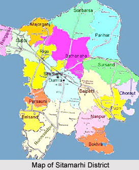
Sitamarhi district is headed by a district magistrate or a deputy commissioner, an officer belonging to the Indian Administrative Service. The district magistrate or the deputy commissioner is assisted by a number of officials belonging to different wings of the administrative services of the state. A superintendent of Police, an officer belonging to Indian Police Services is entrusted with the responsibility of maintaining law and order and related issues in the district. For the purposes of convenient administration, the district has been divided into a number of divisions, subdivisions and blocks. Sitamarhi has three subdivisions and eighteen blocks. The subdivisions are- Sitamarhi Sardar, Sheohar District, Pupri. The blocks of the district are- Bathnaha, Parihar, Nanpur, Bazpatti, Bairgania, Belsand, Riga, Sursand, Pupri, Sonbarsa, Dumra, Runni Saidpur, Majorganj, Puranhia, Suppi, Parsauni, Bokhra, Chorout
History of Sitamarhi District
The district of Sitamarhi holds a sacred place in Hindu mythology. Its history can be traced all the way back to the Treta Yug. It is believed that when Raja Janaka was ploughing the field somewhere near Sitamarhi to impress upon Lord Indra for rain, Sita, the wife of Lord Rama, sprang to life out of an earthern pot. It is said that Raja Janak excavated a tank at the place where Sita emerged and after her marriage set up the stone figures of Rama, Sita and Lakshmana to mark the site. This tank is known as Janaki-kund and is south of the Janaki Mandir. In course of time, the land lapsed into a jungle until about 500 years ago, when a Hindu ascetic, named Birbal Das came to know about the site by divine inspiration. He came down from Ayodhya and cleared the jungle. He found the images set up by Raja Janaka, built a temple over there and commenced the worship of Janaki or Sita. The town however contains no relics of archaeological interest.
Geography of Sitamarhi District
The district of Sitamarhi covers a total area of 2294 Sq. kms. The district lies between the latitudes of 26 degrees 12 minutes north to 26 degrees 49 minutes north and the longitudes of 85 degrees 12 minutes east to 85 degrees 42 minutes east. The district is bounded in the north by Nepal, in the south by Muzaffarpur, in the west by east Champaran and Sheohar Districts and on the east by Darbhanga and Madhubani Distrcts. The maximum temperature experienced by the district ranges between 32 degree Celsius and 41 degree Celsius. Rainfall is normally between 1100mm to 1300mm. Humidity becomes high in the rainy season due to its proximity to Himalaya Mountains Range. The district also gets winter rain, which improves the prospect of Rabi cultivation. The soil of the district can be classified as loam, sandy-loam, clay and clay-loam in different regions. In the Bagmati some alluvial soil is also found which is very good for Rabi cultivation. The soil is mostly rich in mineral elements except zinc. Bagmati, Lakhandei, Adhwara are the main rivers of Sitamarhi.
Demography of Sitamarhi District
According to the Population Census in the year 2011, Sitamarhi District had a total population of 3,419,622. Out of which, the male and female were 1,800,441 and 1,619,181 respectively. The population of Sitamarhi District constituted 3.29 percent of total population of Sitamarhi District. The population density of Sitamarhi district for 2011 is 1,491 people per sq. km. The average literacy rate of Sitamarhi in 2011 was 53.53 compared to 38.46 of 2001. If things are looked out at gender wise, male and female literacy were 62.56 and 43.40 respectively. The total literates in Sitamarhi District were 1,485,896 of which male and female were 917,879 and 568,017 respectively.
Culture of Sitamarhi District
The social composition of the district is a harmonious intermingling of communities. Muslims are the largest minority community and constitute about 30 percent of the population. The Yadavs and the Bhumihars are the most dominating caste as far as socio-political nature is concerned. The district is a storehouse of traditional art and dance. The world famous Madhubani painting is a popular art in the blocks adjacent to the district. Jat-Jatni is a famous folk dance and song of the district. Jhinjhari is another folk dance of the district in which ladies dance with pots on their heads. The region is well known for bangles made of lac are skillfully designed and made here. The lac bangles of Sitamarhi are very famous and are exported to different parts of the state.
Economy of Sitamarhi District
Sitamarhi is primarily an agricultural district. The main Rabi crops grown here are wheat, Arhar, Moong, Khesari, Raiee, and mustard and the main Kharif crops are paddy, sugarcane, and marua. The main industries and trade in the district are also agro-based. The largest industrial unit of the district is Balsand Sugar Factory at Riga, which has been running since 3rd April 1933. It provides employment to about one thousand people. A number of rice mills are also located in the district. Besides, hundreds of single-hullers are distributed all over the district for dehiscing paddy. It is a seasonal industry and the labour force mostly comes from the rural population. Apart from the sugar mill the other industries are of rice and oil seeds. As regards trade, the most important item is rice-both milled and hand-pound. Bairgania Bazar, Sonbarsa Bazar, Pupri and Parihar are the most important centres of rice trade. The other items are pulses and linseed. Trade in Sal wood, which is mostly obtained from Nepal, is also significant.
Tourism in Sitamarhi District
There are a many places of tourist interest situated in the district of Sitamarhi. This place is famous for the Pilgrimage Tourism in Sitamarhi District. These range from places of worship to ancient places of historical worth. A prime attraction among the various places of tourism located here is the birthplace of Sita, the Punaura Janaki Temple. The birthplace of Draupadi, wife of the five Pandavas of Mahabharata, is also located here in Sitamarhi district at Deokuli. Among the other places of tourism here are the Panth-Pakar, the Bodhayan-Sar, Sabhagachhi Sasaul, Pupri etc.
Transport in Sitamarhi District
By Air- Jayprakash Narayan International Airport, Patna and Gaya International Airport are the nearest airports to Sitamarhi.
By Rail- Sitamarhi railway head is well connected. The Railway track connects Sitamarhi to Darbhanga (Broad-Gauge) and Raxaul and Narkatiaganj (meter-gauge).
By Road - There are well connected roads from Sitamarhi to various cities. National Highway - 77 connects it with district Muzaffarpur and Patna. State roadways link it with Madhubani District and Sheohar districts.


