The Grand Trunk Road (abbreviated to GT Road) is one of South Asia`s oldest and longest major roads. For several centuries, it has linked the eastern and western regions of the Indian subcontinent, running from what is now Pakistan, across north India, into Bangladesh.
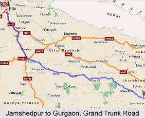
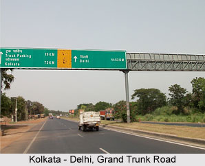 Route of the Grand Trunk Road:Today, the Grand Trunk Road continues to cover a distance of over 2,500 km. It starts from Peshawar in Pakistan and passes through Attock, Rawalpindi and Lahore before entering India at Wagah. Within India, it passes through Amritsar, Ambala, Delhi, Kanpur, Allahabad, Varanasi, Asansol and Kolkata. It then enters Bangladesh and ends at Sonargaon in the Narayanganj district of that country. Within India, the major portion of the road, the stretches between Kolkata and Kanpur, is known as NH-2 (National Highway 2), the stretch between Kanpur and Delhi is called NH-91 (National Highway 91), and that between Delhi and Wagah, at the border with Pakistan, is known as NH-1.
History of the Grand Trunk Road:Recent research indicates that during the time of the Maurya empire, overland trade between India and several parts of western Asia and the Hellenic world went through the cities of the north-west, primarily Taxila (located in present day Pakistan). Taxila was well connected by roads with other parts of the Maurya empire. The Mauryas had built a highway from Taxila to Pataliputra (present-day Patna in Bihar, India). For centuries, the Grand Trunk Road has served as the main highway from travel across northern India.
In the 16th century, a major road running across the Gangetic plain was built newly by Sher Shah Suri, who then ruled much of northern India. His intention was to link together the remote provinces of his vast empire for administrative and military reasons. The Sadak-e-Azam ("great road") as it was then known, is universally recognized as having been the indicator of the Grand Trunk Road.
 The road was initially built by Sher Shah to connect Agra, his capital, with Sasaram, his hometown. It was soon extended westward to Multan and eastward to Sonargaon in Bengal (now in Bangladesh). While Sher Shah died after a briefperiod, and his dynasty ended soon afterwards, the road remained as his outstanding legacy. The mughals, who succeeded the Suris, extended the road westwards at one time, it extended to Kabul in Afghanistan, crossing the Khyber pass. This road was later improved by the British rulers of colonial India. Renamed the "Grand Trunk Road" sometimes referred to as the "Long Walk", it was extended to run from Calcutta to Peshawar and thus to span a major portion of British India.
Over the centuries, the road, which was one of the most important trade routes in the region, facilitated both travel and postal communication. Even during the era of Sher Shah Suri, the road was dotted with carvasarais(highway hotels) at regular intervals, and trees were planted on both sides of the road to give shade to the passers-by.The road was well planned, with milestones along the whole stretch. Some of these milestones can still be seen along the present delhi ambala highway. On another note, the road also facilitated the rapid movement of troops and of foreign invaders. It expedited the looting raids, into India`s interior regions, of Afghan and Persian invaders and also facilitated the movement of British troops from Bengal into the north Indian plain.
The Grand Trunk Road continues to be one of the major arteries of India and Pakistan. The Indian section is part of the ambitious Golden Quadrilateral project. For over four centuries, the Grand Trunk Road has remained "such a river of life as nowhere else exists in the world".


