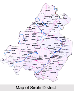
 Sirohi district is located in the south-western part of the state of Rajasthan. The district is in the shape of an irregular triangle, with the apex near the village of Harji in the extreme north and the base extending west by north-west from a point where the territories of the former states of Sirohi, Idar and Danta meet. Sirohi is bounded by district Pali in the north-east, Udaipur district in the east, Jalore district in the west and Banaskantha district of Gujarat in the south. Sirohi is the third smallest district in the state of Rajasthan after the districts of Dungarpur and Banswara. Given below is a glimpse into the basic profile of the district.
Location of Sirohi District
Sirohi district is situated in the south-west part of Rajasthan between the parallels of 24 degrees 20 minutes and 25 degrees 17 minutes North Latitude and 72 degrees 16 minutes and 73 degrees 10 minutes East Longitude. It has an area of 5139 kms (2009 sq. miles) and is the third smallest district of Rajasthan, after Dungarpur and Banswara district. Sirohi is bounded by Pali district in the north-east, Udaipur district in the east, Jalore district in the west and Banaskantha district of Gujarat in the south. The total geographical area of the district is 5139 sq. kms. It covers about 1.52 percent of the total area of Rajasthan.
History of Sirohi District
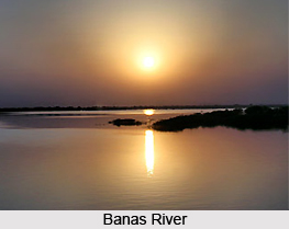
History of Sirohi district follows a long and rich tradition. The district, located on the western slope of the Siranwa hills, is said to derive its name from the same. Sirohi formed a part of the powerful kingdom at Mount Abu, which came under the rule of a number of fierce dynasties. Lumba, a scion of the younger branch of the rulers of the Chauhan dynasty at Jalore, seized Abu from the Parmars in the year 1311 A.D. and became the first king of the territory now known as the kingdom of Sirohi. The famous town of Chandravati situated on the bank at the Banas River, was the capital of the kingdom and Lumba took his residence there and ruled till 1320 A.D. The sixth descendant in line from Lumba, gave up Chadravati and built a town below the Siranwa hill. This town however proved to be unhealthy and the present town of Sirohi was founded by his son Sahasmal nearby. He founded a fort here as well, making it the capital of his kingdom. Later all the area under the Deoras came to be known as Sirohi. With the independence of India in 1947 the process of integration of princely states of India started. The Sirohi state was merged on 16th November 1949 with the state of Rajasthan.
Geography of Sirohi District
The district generally has a dry climate, with the average rainfall standing at 665 mms. Among the major rivers flowing through the district are the Jawai, Sukhadi, Khari, Bodi, Krishnavati, Kapalganga and Banas. The main dams of the district are Banas, Oda, Danta, Chandela, Girwar, Niboda, Javal, Karodi Dwaj, Angor etc. The district is primarily agricultural and the crops grown here include millets, pulses, sesame and red chillies. The hot season is somewhat milder than in the adjoining districts to the north and north-west. The average winter temperature experienced by the district is around 23 degree Celsius, with summer temperatures hitting a maximum of 47 degrees. The major languages spoken in the district are Hindi and the Rajasthani language. The main urban centres here are Abu Road, Rewdar, Sibganj, Mount Abu and Pirwara. Literacy rate at the last count was 91.76 percentages, where males stand at 54.39 percent literacy and females at 37.37 percent.
Culture of Sirohi District
Culture of Sirohi District is reflected in the various art forms that are found existing here. A variety of song and dance rituals and customs are typical to the place. These include the Mayra Song, Banada and Toran all of which are sung on the occasion of marriage. Others include Gair dance, the Gachhi Ghodi etc. In the field of paintings too the district has a rich tradition. Paintings in the Sirohi district are based on the folk style and greatly influenced by the Mewar, Marwar and Mughal styles. A number of fairs and festivals are also held in the Sirohi district. Some of the popular fairs in the district are the fair of Kambeshwar Mahadev, fair of Vambeshwar Mahadev, Bhuteshwar Fair, Karrodidwaj Fair etc.
Economy of Sirohi District
The district is mainly an agricultural district, and the main crops grown here include jowar, bajra, maize, pulses, sesame, groundnut, and castor seed, wheat, barley, rapeseed and mustard seeds. The major industries contributing towards the economy are those engaged in the manufacture of dairy products, bread, ice, cotton spinning, chemicals, plastic products, cement, and surgical equipment. The main industrial centres are located at Abu Growth Centre. The main markets are at Sheoganj and Abu Road.


