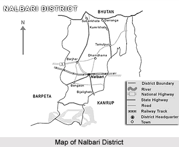
 Nalbari District, an administrative district of Assam, is situated in between Kamrup District and Barpeta District. For better administration, old Kamrup District had been divided into three districts. Nalbari was declared a sub division of undivided Kamrup District in the year 1967. Nalbari Sub Division is formally declared as a district in 14th August 1985. District headquarters of this administrative district of Assam are situated at Nalbari. Nalbari District covers an area of 2257 sq km.
Geography of Nalbari District
The entire area of Nalbari District is situated at the plains of the Brahmaputra River valley. The tributaries of Brahmaputra namely Nona, Buradia, Pagaldia, Borolia and Tihu, which originate from the foothills of the Himalayan Mountain Range, are wild in nature. These rivers have enormous contribution towards the agrarian economy of the district. Soils of Nalbari District are heterogeneous. Soil of the northern part of the district is clayey and loamy whereas the middle part is loamy and sandy. Further, soil of the southern part of Nalbari District is composed of sandy soil. The climate of this district is sub-tropical with semi dry hot summer and cold winter. During the summer season, generally during the months from May to August, heavy rainfall occurs. As a result of which the district experiences flood. The district receives average annual rainfall.
Demography of Nalbari District
 According to the 2011 Census, the Nalbari District had population of 769,919 of which male and female were 395,804 and 374,115 respectively. The population of Nalbari District constituted 2.47 percent of total population of Assam. The population density of Nalbari district shows 763 people per sq. km. The average literacy rate of Nalbari was 79.89 percent. If things are looked out at gender wise, male and female literacy were 85.58 and 73.85 respectively.
Education in Nalbari District
Nalbari District is famous for Sanskrit education. Nalbari is known as `Nabadeep` of Assam because it has various Sanskrit language education centres. The first Middle School was established in Nalbari in the year 1887. In 1917, it was formally declared as Nalbari High School. Later on this school was named as `Nalbari Gordon High School`. With the passage of time, different schools and colleges were established at Nalbari District. Literacy percentage of Nalbari District is around 55.99 percent.
Tourism in Nalbari District
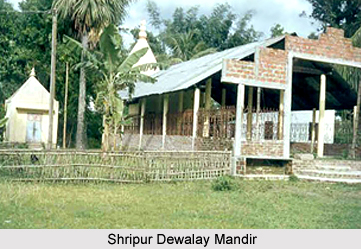
Tourism in Nalbari District reflects the picturesque beauty as well as the enriching history of the district. Some of the popular tourist attractions of this place are Hari Mandir, Jain Temple, Billeswar Temple, Buddhist Temple, Shripur Dewalay Mandir, Bagheswari Dewbahar Guri Devalay, Ganga Pukhuri, Mahmara Pukhuri, Angradhowa Pukhuri and more.
Nalbari District has several small-scale industries. Besides, agriculture, there are various sectors that contribute to the economy of Nalbari District such as fisheries, animal husbandry, sericulture and handicraft industries.


