 Karimganj District is one of the 27 districts of Assam with its district headquarters at Karimganj. The district is bounded on the north by Bangladesh and Cachar district; on the south by Mizoram and Tripura, on the west by Bangladesh and Tripura and on the east by Hailakandi district. Karimganj District has a strategic location. It also shares an international border with neighbouring country Bangladesh. The administration of Karimganj District comprises one sub-division, which is also named as Karimganj. There are five Revenue Circles (Tehsils), namely Karimganj, Badarpur, Nilambazar, Patherkandi and Ramkrishna Nagar under this sub-division. Several officers like Additional Deputy Commissioner, Sub-divisional Officers, Extra Assistant Commissioners and others, aid the Deputy Commissioner. The main objective of the administration is overall development of the district
History of Karimganj District
History of this district is divided into four periods - early period, middle age, British Era and the country`s partition period. However, early history of this district is quite unclear and ambiguous. It does not have proper evidences either. In the 7th Century AD, Karimganj region along with foothills of North Cachar Hills had passed on to the Samatata Kingdom of the East Bengal. In 10th century AD, King Srichandra of the renowned Chandra Dynasty of Eastern Bengal included this region within his Vanga Kingdom. In 1765, the Sylhet district (of which Karimganj was a part) passed on to the British East India Company. However, the Karimganj sub-division under Sylhet District was formed in 1878 with its headquarters at Karimganj town.
Geography of Karimganj District
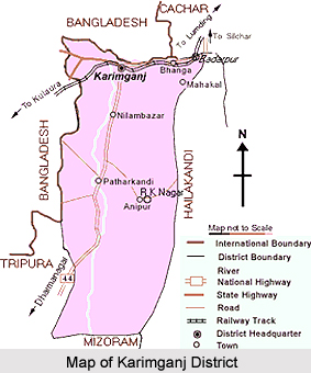
Geography of Karimganj District specifies the strategic location of the district. Karimganj district is located between longitudes 92 degrees 15 minutes and 92 degrees 35 minutes east and latitudes 24 degrees 15 minutes and 25 degrees 55 minutes North. The ecological features of this region include agricultural plains, low wetlands, hilly terrains, forests, various rivers, and their tributaries. The district is located at the southern portion of the state and occupies a total area of near about 1809 sq kilometres. Huge area of Karimganj District is covered by forests. It also includes several hilly ranges that run across the district.
Demography of Karimganj District
According to the Population Census in 2011, Karimganj District had population of 1,217,002. Out of which the male and female were 620,722 and 596,280 respectively. The population of Karimganj District constituted 3.90 percent of total population of Assam State. The population density of Karimganj district for 2011 is 673 people per sq. kilometres. The Karimganj district administers 1,809 square kilometres of areas. The average literacy rate of Karimganj in 2011 was 79.72 percent. The male and female literacy rates were 85.70 percent and 73.49 percent respectively. The total literates in Karimganj District were 808,165 of which male and female were 443,047 and 365,118 respectively.
Economy of Karimganj District
Economy of Karimganj district is agrarian in character. The district suffers from lack of infrastructure and poor communication facilities. The main sector of economy that is agriculture is primitive in nature with poor productivity. However, there is enough scope for development if the inherent strengths and unique advantages are adequately harnessed. Moreover, an active workforce in Karimganj district is engaged in trade and commerce. There is no large or medium scale industry in the district. Among plantation crops, tea and rubber are the major ones. Karimganj District has huge potential for fishery, being endowed with a large number of rivers, swamps, ponds and other natural water bodies. Livestock and poultry occupy an important place in the rural economy and act as household assets. Timber, bamboo, cane, stone and sand are the major forest products of the district.
Tourism in Karimganj District
There are not many places to visit in the town of Karimganj. It is served as a place where a visitor can merge as one with nature. It is an ideal destination for any tourist who is looking to get away from the hustle and bustle of popular tourist destinations and spend a few weeks in peace .There are also many forests in the adjoining regions of Karimganj, and these can be visited during your trip to the town. The tourist can also take along a tent and camp out in the wild, as Karimganj has many people who travel from nearby locations in order to picnic in the place. Although various modes of communication to Karimganj district is available, due to its remoteness, the existing transportation and communication facility is a major block in the development process of the district. The major road link to the district is National Highway 44, which starts from Shillong in Meghalaya and after passing through Karimganj, goes up to Agartala in Tripura. Badarpur, in Karimganj district is still now the major railway junction and main hub in the entire Barak Valley and southern region of Assam. Direct train services are available to Guwahati, Lumding, Silchar, Dharmanagar-Kumarghat (in Tripura), Bhairabi (Mizoram). Karimganj district does not have its own airport. The nearest airport is at Kumbhirgram (near Silchar) at a distance of 83 kms from Karimganj town.


