


 Karbi Anglong District is one of the 27 administrative districts of Assam. In fact, it is the largest amongst all the districts. Karbi Anglong District is covered on the east by Golaghat District, on the west by Meghalaya and Marigaon District, on the north by Nagaon District and Golaghat districts and on the south by North Cachar Hills District and Nagaland. The administration of Karbi Anglong District is well administered by the governmental officials. The administrative headquarters of Karbi Anglong District is located at Diphu town. Karbi Anglong District is positioned between 25 degrees 33 minutes to 26 degrees 35 minutes north latitudes and 92 degrees 10 minutes to 93 degrees 50 minutes east longitudes. This administrative district of Assam covers a total area of 10,434 sq km. Karbi Anglong District is one of the 27 administrative districts of Assam. In fact, it is the largest amongst all the districts. Karbi Anglong District is covered on the east by Golaghat District, on the west by Meghalaya and Marigaon District, on the north by Nagaon District and Golaghat districts and on the south by North Cachar Hills District and Nagaland. The administration of Karbi Anglong District is well administered by the governmental officials. The administrative headquarters of Karbi Anglong District is located at Diphu town. Karbi Anglong District is positioned between 25 degrees 33 minutes to 26 degrees 35 minutes north latitudes and 92 degrees 10 minutes to 93 degrees 50 minutes east longitudes. This administrative district of Assam covers a total area of 10,434 sq km.
History of Karbi Anglong District The birth of Karbi Anglong District took place on 17th November 1951. The new district was formally created with some parts of Golaghat District, Nagaon, Cachar District and United Khasi district of Meghalaya for all round development of the tribal folk of the Central Assam. It was followed by bifurcation of the former district of United Mikir and North Cachar Hills district into two separate districts under the name of 'Mikir Hills' and North Cachar Hills district in 1970. The Mikir Hill district was again rechristened as 'Karbi Anglong District' on 14th October, 1976 under government notification. Thus, Karbi Anglong District came into being as a full-fledged separate district with its Head quarter at Diphu. This district enjoys autonomy under the provision of Sixth Schedule of the Constitution of India. Geography of Karbi Anglong District The Karbi Anglong Distrcit is situated in the central part of Assam. The district has extensive dense tropical forest covered hills and flat plains. The geography of Karbi Anglong District mostly consists of plains and covered hills. Due to variation in the topography, this hill zone experiences different climates in different parts. The cold weather season commences from October and continues till February. During the hot weather season, the atmosphere becomes humid. The temperature ranges from 6 degree to 12 degree and 23 degree to 32 degree Celsius in summer. The average rainfall is about 2416 mm. There are numerous rivers and tributaries in this district. Some of the prominent rivers of this district are Kopili River, Nambor River, Amreng River, Deopani River, Borpani River, Yamuna River, Kolioni River, Patradisha River, Dhansiri River and more. Even though, the district is dotted with hills, a few of them can be categorized into Mountain. Among them, the highest is the Singhason Peak which is at around1360 metres above the sea level. Demography of Karbi Anglong District Population of Karbi Anglong District is predominantly tribal. The major tribal ethnic groups of this district of Assam are Karbi tribe, Bodo tribe, Kukis, Dimasa tribe, Hmar tribe, Garo tribe, Naga tribe and Tiwas. Besides, a large number of non-tribal groups also live together in this hill region. According to the Population Census in the year 2011, Karbi Anglong District had a population of 965,280 of which male and female were 493,482 and 471,798 respectively. The population of Karbi Anglong District constituted 3.10 percent of total population of Assam. The population density of Karbi Anglong district is 93 people per sq. km. The average literacy rate of Karbi Anglong in 2011 was 73.52 percent. If things are looked out at gender wise, male and female literacy were 82.12 and 64.62 respectively. Economy of Karbi Anglong District Karbi Anglong District is basically an agricultural district. Thus, its economy entirely depends on agriculture. Different types of agricultural crops are cultivated among which paddy is the main crop. Except for the valleys, the people in this region follow the jhum system of cultivation. The economy of this district is also depending on art and crafts. The crafts of Karbi Anglong District is famous not only in Assam, but also different parts of India. Tourism in Karbi Anglong District Karbi Anglong is known as the land of the Karbi Tribes. This beautiful, large sprawling district lies in the centre of Assam. This charming hills district with its diversely rare flora and fauna has remained untouched and undiscovered. Some of the major tourist attraction sites are Amreng Tourist Centre is located on the bank of Amreng River, Khanduli Tourist Centre and the Umwang Tourist Centre. This district is famous for trekking expedition. The expeditions to Singhason Peak, the highest peak of the district with altitude of about 1600 mtrs, through rainforest, the rocky hills give the adventurous thrill to the tourists. The expeditions will have additional thrill while evaluating with varieties of birds and animals including barking deer, pygmy hog, spotted deer, and varieties of monkeys, langurs, birds of unspecified and specified varieties including Himalayan Great Horn Bills in their natural home. Karbi Anglong District is well connected with other districts of the state through various routes. On the north it is covered by NH-36 and on the east by NH-39. Moreover, the north frontier railways pass through the district touching only a few points along the boundary. These are Hawaipur, Lamsakhang, Borlangphar, Langsoliet, Nilalung, Diphu, Doldoloi, Dhansiri, Rongapahar, Khotkhoti and Bokajan. However, there is no airport in the district. The airport in Dimapur is 54 km away from Diphu being the nearest to the district. |
| |||


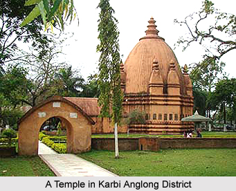
Karbi Anglong District
| Karbi Anglong District is the largest administrative district of Assam. This administrative district is located at the central part of the state with its headquarters located at Diphu town.. |
| ||||||||||||||||||||||||||||

