


 Jorhat District is one of the districts of Assam. It is located between the Brahmaputra River on the north and Nagaland on the south. Jorhat District is situated at around 26 degrees 46 minutes north latitude and 96 degree 16 minutes longitude in the central part of Brahmaputra Valley. Jorhat town is the district headquarters of Jorhat District. Initially, Jorhat was sub-division of undivided Sibsagar District. In 1983, Jorhat was curved out of Sibsagar District. The present Jorhat District consists of three Sub-divisions namely Jorhat, Majuli and Titabor. The district is divided into six revenue circles and eight development blocks. Jorhat District is one of the districts of Assam. It is located between the Brahmaputra River on the north and Nagaland on the south. Jorhat District is situated at around 26 degrees 46 minutes north latitude and 96 degree 16 minutes longitude in the central part of Brahmaputra Valley. Jorhat town is the district headquarters of Jorhat District. Initially, Jorhat was sub-division of undivided Sibsagar District. In 1983, Jorhat was curved out of Sibsagar District. The present Jorhat District consists of three Sub-divisions namely Jorhat, Majuli and Titabor. The district is divided into six revenue circles and eight development blocks.
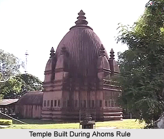
History of Jorhat District Jorhat District was established as the new capital after the decline of Tunkhungia Ahom Dynasty. Jorhat as the name signifies was just a couple ("Jor") of huts. It means two parallel marts, namely, Chowkihut and Macharhut, which lay on the eastern and the western banks of the river Bhogdoi. Jorhat today has grown into a thriving cosmopolitan town with a strong sense of character and identity. The civil sub-division under Sibsagar district was created in 1869. Further, the British rule in the country also contributed to the formation of Jorhat District. It is the best laid out town in the upper Assam region with broad roads, cutting each other at right angles. The variety of heterogeneity of the town population is commendable. Geography of Jorhat District Jorhat district occupies an area of 2,851 square kilometres. The annual rainfall of the district is 2029 mm. The Brahmaputra River is situated on the north of the Jorhat district. This river forms the largest riverine island of the world, Majuli Island, spreading over 924.6 square kilometres with a population of about 1.50 lakh being threatened by the constant soil erosion by the river. Majuli had been the principal place of pilgrimage for the people who believe in Vaishnavism since the ages of the Ahom reign. There are several "Satras" resembling medieval monasteries headed by Satradhikars. They preached and taught the Vaishnavism, which Srimanta Sankardeva initiated, (1449-1568). Demography of Jorhat District Jorhat District had a population of 1,091,295 of which male and female were 557,944 and 533,351 respectively. This was revealed in the Population Census in 2011. The population of Jorhat District constituted 3.50 percent of total population of Assam. The population density of Jorhat district is 383 people per sq. km. Jorhat district administers 2,851 square kilometres of areas. The average literacy rate of Jorhat was 83.42 percent. The male and female literacy rate was 88.38 percent and 78.22 percent respectively. The total literates in Jorhat District were 812,328 of which male and female were 440,230 and 372,098 respectively. Culture of Jorhat District Jorhat District is popular for its glorious heritage and culture. The cultural environment that prevails in Jorhat District is the result of untiring effort of people to preserve its culture. Jorhat District has produced many creative writers, historians and journalists. Jorhat District has been the hometown of several renowned personalities like Krishna Kanta Handique, Shiva Prasad Baruah, Hemendra Prasad Baruah, Debeswar Sarma, Dinabandhu Dr. Prasad Bordoloi, Hiren Bhattacharya and Zubeen Garg. Education in Jorhat District Jorhat District is considered as a good place for modern education. The Jorhat Government High School is the oldest school established in the year 1883 with special facilities for science teaching. The Jagannath Barooah College is the oldest College in the district. It was set up in the year 1930 and said to be first college in upper Assam. Later, several degree colleges and schools came up. Jorhat District the Agricultural University established in the year 1948. In addition, it also has the Engineering College, Regional Research Laboratory, Prince of Wales College of Polytechnic (1926) along with other prestigious establishments like Air Force Base, ONGC, etc. Tourism in Jorhat District Tourism in Jorhat District includes several places of interest. The amazing tourists' spots offer the tourists a pleasurable experience filled with adventure and calmness. Some places of tourist attraction are Dakhinpat Satra, Auniati Satra, Bengenaati Satra, Majuli, Karanga, Kunwori Pukhari, Ladaigarh and Thengal Bhawan. These are place of nature tourism, pilgrimage tourism and leisure tourism. |
| |||


Jorhat District
| Jorhat District is an administrative district of Assam with its headquarters at Jorhat town. Jorhat District is known for its educational system and cultural heritage. The economy of Jorhat District is mainly dependent on agriculture. |
| ||||||||||||||||||||||||||||

