


 Geography of Raichur District deals with the landforms of Raichur District, where the soil has the rich content of black soil. Raichur District is situated in the state of Karnataka in between the Tungabhadra River and the Krishna River. Geography of Raichur District deals with the landforms of Raichur District, where the soil has the rich content of black soil. Raichur District is situated in the state of Karnataka in between the Tungabhadra River and the Krishna River.
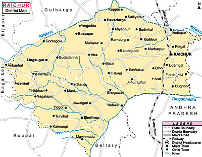
Latitudinal Extent of Raichur District Raichur District lies between 15 degrees 9 minutes and 16 degrees and 34 minutes North latitude and 75 degrees 46 minutes and 77 degrees 35 minutes East longitude. The general slope of the district is from the north-west towards the south-east, its average height above the Mean Sea-Level being just 1,311 feet. Extension of Raichur District Raichur district is bounded on the North by the Gulbarga district, on the West by Bijapur district and Dharwad district, on the East by the Mahbubnagar district of Andhra Pradesh, and lying on the South are the districts of Kurnool and Bellary. The two rivers, the Krishna and the Tungabhadra, form the entire northern and southern boundaries of the district. The geographical area of the district, according to the Central statistical organization of the Government of India, is 14,013 Sq Kilometres which works out to 5410 sq. miles. Climate of Raichur District The climate of Raichur district is characterised by dryness for the major part of the year and a very hot summer. The year may be divided broadly into four seasons. The hot season begins by about the middle of February and extends to the end of May, South-west monsoon is from June to end of September. October and November are the post monsoon or retreating monsoon months and the period from December to the middle of February is the cold season. The coldest month is that of December, with the mean daily maximum temperature being around 29.3 Degree Celsius and the mean daily minimum at 17.7 Degree Celsius. May is the hottest month, the mean daily maximum temperature being 39.8. The heat is oppressive till the onset of the south-west monsoon by about the first week of June. Thereafter the weather becomes slightly cooler and continues to be so till the end of the South-west monsoon season. Day temperatures show a slight increase in October. From November, both day and night temperatures gradually decrease till December. The low and highly variable rainfall renders the district liable to drought. The region around Lingsugur gets the least amount of rainfall in the district while towards the south as well as the east, rainfall increases. During the south-west monsoon months, viz., June to September, the district receives the highest rainfall. In the post-monsoon months of October and November also, the district receives some rain. The variations in the annual rainfall from year to year are large as is the case in the neighbouring districts. Skies are moderately to heavily cloud in the south-west monsoon months. In the post-monsoon months, clouding is somewhat less. Clear or lightly clouded skies are common in the rest of the year. Soil of Raichur District The undulating black cotton soil strips, cut by numerous nalas, characterise the region of the Dharwad schists, which is now practically denuded of trees and presents a monotonous landscape, while the gneissic region is generally more or less broken and covered with a thin mantle of red loamy soil. Gneissic hills and sedimentary formations, which cover a small belt of the region adjoining the confluence of the Krishna River and the Tungabhadra River, occupy more or less flat plateaus. Landform of Raichur District Regionally viewed, the hills in the area present some structural features which are of interest in relation to the geology of the area: 1) Taking the most south westerly group, the hills of Karigudda, Manvi and Rabhinakal show a continuity along roughly north-west south-east directions: 2) from Sirwar and Yermasagar, running in a roughly south-east direction, may be recognised the hill of Madhugiri, Neermanvi, Gorkal, Kurvi and the one two miles west of Kamalahatti; 3) between Masarakal and Gabbur, a number of gneissic hills are seen at Kakarga, Jinnapur, Hungundabad, Ramdurga, Jagatkal, Khardigud, Maladkal and Gabbur. The hills around Uttanur are seen to be in line with the south-western group of hillocks in the above areas also the hill-clusters around Kalmala and Kallur, are seen to be situated in the same north-west and South-east disposition as that of the group of gneissic hills enumerated above; and 4) the hills around Raichur, which constitute a prominent landmark in the area, may also be seen roughly to display north-west and south-east trends. |
| |||


Home > Travel > States of India > Karnataka - Indian State > Districts of Karnataka > Geography Of Raichur District
Geography Of Raichur District
| Geography of Raichur District is characterised by undulating black cotton soil strips in the Dharwar schist region and a thin mantle of red loamy soil in the gneissic region; the district has a dry climate for the major part of the year. |
| ||||||||||||||||||||||||||||

