 Arunachal Pradesh is the eastern most state of the Indian subcontinent and meaning of the word "Arunachal Pradesh" stands as a land of dawn lit mountains. The state is bounded by Assam, Nagaland, Bhutan, Myanmar, Burma and China. Most of the people in Arunachal Pradesh are Tibeto-Burman in origin.
Itanagar is the capital of Arunachal Pradesh and it is located in the Papum Pare district of the north-eastern state. The state of Arunachal Pradesh has been divided into fifteen districts each administered by a district collector who looks after the need of the local people.
The fifteen districts of Arunachal Pradesh are as follows:
•Anjaw District
•Changlang District
•East Kameng
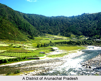
•East Siang
•Kurung Kumey
•Lohit District
•Lower Subansari
•Papum Pare
•Tawang District
•Tirap District
•Dibang Valley
•Upper Subansari
•Upper Siang
•West Kameng
•West Siang
Anjaw is a newly created district of the state and is one of the administrative districts of Arunachal Pradesh. Hawai is the district headquarters of Anjaw.
Changlang District is known for its tribal population. Most of the tribal population of the state form a part of the Changlang District. The Namdapha Tiger Reserve is also an important tourist attraction of Changlang District.
East Kameng District of the state is located in the cold tundra regions of the country. The district is known for its variety of culture which is predominant among the tribal population dwelling in the district.
East Siang is also an administrative district of Arunachal Pradesh. The people dwelling in the region mostly follow Donyi-Polo but a sizeable population have presently been converted to Christianity.
Kurung Kumey is a newly established district of Arunachal Pradesh. Kurung Kumey has Koloriang as the district headquarters.
Lohit District has been named after the Lohit River. The district although is an administrative district is very much inaccessible. The district is also home to a number of tribes of Arunachal Pradesh.
The Dibang Valley District of Arunachal Pradesh has been named after the Dibang River and the district has further been subdivided into Lower and Upper Dibang Valley for the sake of administrative convenience. The headquarters of Lower Dibang Valley is Roing and that of Upper Dibang Valley is Anini.
Lower Subansiri is also an administrative district of Arunachal Pradesh and the headquarters of the district is Ziro. The district is mostly inhabited by Nyishis and Apatani Tribe. Some of the major festivals of the region are Nyokum, Boori-Boot and Dree Festival.
Papum Pare District of Arunachal Pradesh is important because it houses Itanagar, the state capital. It is an administrative district and a large number of the population are followers of Donyi-Polo.
Tawnag District is known for its ethnicity because ethnic people like the Monpa tribe in the district. The most predominant economic activity of the region is agriculture. The Tawang Monastery is a major attraction of the district.
Tirap District is located in the north-eastern part of Arunachal Pradesh. The district is covered with hills and the famous Namdapha National Park is in the district of Tirap. The people dwelling in the region mostly follow Hinduism and Animism and the place is known for its rich and vibrant folk culture.
Upper Subansiri is an administrative district of Arunachal Pradesh. Daporijo is the district headquarters. Members of several tribes like Tagi, Hill Mari and Galo are found in the district of Upper Subansiri.
Upper Siang is known for its Hydro Electric Project. Members of Adi and Memba are found in the district and they generally follow Donyi-Polo and Tibetan Buddhism.
West Kameng is a large district of Arunachal Pradesh in terms of area. It accounts for 8.86 percent of the total area of the state. The name of the district has been derived from Kameng River, which is a tributary of Brahmaputra River.
West Siang is also an administrative district of Arunachal Pradesh. An important attraction of the region is the Tibetan-Buddhist Temple known by the name Mechuka Gompa. The district is also home to a number of tribal communities. The headquarters of the district is Aalo.


