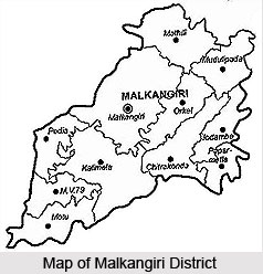
 Malkangiri District is named after its headquarters town Malkangiri. This administrative district of Orissa has an area of 5,791 sq kms. Malkangiri District lies between 17 degree 45 minutes north to 18 degree 40 minutes north latitudes and 81 degree 10 minutes east to 82 degree east longitude. Oriya is the main language spoken in the district. Malkangiri District is sparsely inhabited by primitive tribes notable among them are Bonda Poraja Tribe, Koya Tribe and Didayis. Malkangiri District is bounded by Andhra Pradesh and Chhattisgarh. In the east Malkangiri District is bounded by Koraput District, Vishakhapatnam and East Godavari District of Andhra Pradesh. In the west Malkangiri District is bounded by Bastar District of Chhattisgarh. In the north by Koraput district of and in the south by East Godavari and Khammam district of Andhra Pradesh.
History of Malkangiri District
During formation of Orissa Province in 1936 Malkangiri was a `Taluk` of Nabrangpur subdivision of Koraput District of Orissa. In 1962, it was upgraded to a sub-division of Koraput District. The present Malkangiri District got its identity as an independent district due to re-organization of districts of Orissa as per government notification on 1st October, 1992 with effect from 2nd October 1992.
Geography of Malkangiri District
Malkangiri District is divided into two distinct geographical divisions. The eastern part is covered with steep Ghats, plateaus, valleys. The rest of the district is comparatively flat plain broken by a number of rocky wooded hills. Almost the whole of the district is covered with a vast dense forest. The climate of Malkangiri District is generally cold in winter season and hot in the summer season with temperature ranging from 13 degree Celsius to 47 degree Celsius. The average annual rainfall in the district is about 1700 mm. Relative humidity is generally high especially in the monsoon and post-monsoon months. During the rainy season it becomes swampy and heavy floods isolate it from the outer world. Major rock groups are granite, quartzite, sandstone, limestone, slate and marble. Dolomite, Asbestos, Tin and steatite are the important minerals of the district. The district is backward in irrigation in comparison with other districts due to its high hills and dense forests. The soil is poor for cultivation.
Tourism in Malkangiri District
There are several places of tourist attraction in Malkangiri District. Tourism in Malkangiri District offers visits to several historical and religious sites. Further, the natural beauty of the place enhances the travelling experience in the district. Bonda Hills, Ammakunda, Satiguda Dam, Manyamkonda, Hill Temples, etc. are some of the main attractions of Malkangiri District.
Malkangiri District is noted for its small scale industries. Economy of Malkangiri District is based on agriculture as it is the main occupation of the people. Forestry and fishing are the other occupations of the inhabitants. Malkangiri District is one of the most backward districts of Orissa.


