


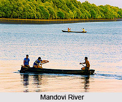
 Mandovi River, also known as Mahadayi or Mhadei River, is an Indian river. It originates from Bhimgad in the Sahyadri range of mountains in the Karnataka state of India. Along with the Zuari River, the Mandovi is the backbone of Goa as the river has the largest drainage basin in the state. Boat ride and cruise are the highlights of this river. Cruises on this river is said to provide an enjoyable and memorable experience. Mandovi River, also known as Mahadayi or Mhadei River, is an Indian river. It originates from Bhimgad in the Sahyadri range of mountains in the Karnataka state of India. Along with the Zuari River, the Mandovi is the backbone of Goa as the river has the largest drainage basin in the state. Boat ride and cruise are the highlights of this river. Cruises on this river is said to provide an enjoyable and memorable experience.
Flowing and Source of Mandovi River The river enters Goa from the north via the Sattari taluka. During its course it flows through Cumbarjua, Divadi and Chodne. Both the Zuari and the Mandovi evacuates into the Arabian Sea at a common point at Cabo Aguada forming the Marmogoa Harbour. The Mandovi River flows for nearly seventy-seven kilometers, twenty-nine kilometers in Karnataka and fifty-two kilometers in Goa. It has a catchment area of 2032 km2 in Karnataka and 1,580 km2 in Goa. Tributaries of Mandovi River Mandovi River has several tributaries namely Rogaro, Kushavati, Nanorem, Nanuz, Valvota and Mapusa. Significance of Mandovi River Panaji, the state capital and the town of Old Goa are situated on the left bank of the Mandovi River. The Cumbarjuem Canal has made the remote areas of the Mandovi accessible to ships, which brings iron ore from the mines in the eastern hills. Near the town of Old Goa, there are three large freshwater islands Divar, Chorao and Vashee in Mandovi River. The island of Chorao houses Salim Ali Bird Sanctuary. There is a regal Mandovi Bridge near Panjim spanning across Mandovi River. This bridge links the towns of Panjim to Porvorim. Attractions of Mandovi River The Mandovi River offers one to experience cruise. One can avail GTDC operated yacht that provides a cultural performance of folk songs and dances of Goa. The company also offers many other cruising options for visitors from one-hour jaunts to a five-hour excursion where one can spot dolphins. All cruises depart from the Santa Monica Jetty next to the huge Mandovi Bridge. One can also opt for a pedal boat ride and enjoy th e beauty of Mandovi River. |
| Articles you would like to read with Mandovi River |
|
||||||||||||

