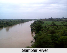
 Gambhir River is an Indian river that flows in the Rajasthan state of India. It is a seasonal river and flows only in rainy season. The Gambhir River Basin is located in northeastern portion of Rajasthan. The districts in this region are Sawai Madhopur, Bharatpur, Dausa, and Dhaulpur.
Origin and Flowing of Gambhir River
The Gambhir River rises in the hills near Karauli village of Sawai Madhopur District in the western state of India, Rajasthan. It flows from the south direction to the north direction up to Kanjoli village (Toda Bhim) and travels in the northeast direction up to village Mertha of Roopbas Block before going inside Uttar Pradesh.
The river once again enters Rajasthan near Catchapaura village in Dholpur district where it forms a borderline between Uttar Pradesh and Rajasthan. It then enters Mainpuri district in the Indian state of Uttar Pradesh and ultimately evacuates itself in the Yamuna River. The important tributaries of the Gambhir River are Sesa, Kher and Parbati. The total length of the river in Rajasthan is 288 km.
Attractions of Gambhir River
The river flows between Bayana City which is a historical place and Brahmbad village in Bharatpur District. It is a great source of water for Keoladev Ghana Bird Sanctuary in Bharatpur, Rajasthan. The sanctuary is home to over 230 species of birds.
This article is a stub. You can enrich by adding more information to it. Send your Write Up to content@indianetzone.com


