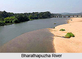
 The Bharathapuzha River is the second longest river in Kerala with a length of 209 kilometers. It is also known as Nila, Kuttipuram Puzha and Ponnaniyar. The river originates in the Annamalai hills located in the Western Ghats region in Tamil Nadu. It flows in the west direction along with the many of its tributaries including the Tirur River through Palakkad Gap, Palakkad, Thrissur and Malappuram districts of Kerala. For the first forty kilometers, Bharathapuzha River flows in the northwards direction till Pollachi. The Kannadippuzha and Kalpathippuza, the tributaries of Bharathapuzha meet at Parli and flows in the west direction as Bharathapuzha River. The Bharathapuzha River then surrenders itself into the Arabian Sea at Ponnani. Gayathripuzha River, Kannadipuzha River, Kalpathipuzha River and Thuthapuzha River are the main tributaries of the Bharathapuzha. The Thutapuzha River merges with Nila at Pallippuram making the waters of Nila richer in mineral content.
The tributaries also branch out and form several tributaries, which are the distributaries of the Bharathapuzha River. The tributaries of Thuthapuzha River are Kunthippuzha, Kanjirappuzha, Ambankadavu, and Thuppanadippuzha. The tributaries of Gayathripuzha are Mangalam, Ayalurpuzha, Vandazhippuzha, Meenkarappuzha and Chulliyar. The tributaries of Kalpathipuzha are Korayar, Varattar, Walayar and Malampuzha. The tributaries of Kannadipuzha are Palar, Aliyar and Uppar.
The Bharathapuzha River is not navigable in most parts except in small parts where it joins the sea. With a drainage basin of 6,186 square kilometers, Bharathapuzha basin is the largest river basin in Kerala. Out of the total drainage area two thirds, which is 4400 square kilometers, is in Kerala and the remaining 1786 square kilometers is in Tamil Nadu. The major towns situated on the bank of the Bharathapuzha River are Palakkad, Parli, Killikkurussimangalam, Ottappalam, Shoranur, Pattambi, Thrithala, Thiruvegappura, Kudallur, Pallipuram and Kumbidi.The Parudur village and the town of Pallipuram are situated at the meeting point of Thuta River also called Thutapuzha.
There are several dams constructed across this river of which the Malampuzha dam is the largest built across Bharathapuzha and its tributaries. Other dams constructed are Walayar dam, Mangalam dam, Pothundi dam, Meenkara dam and Chuliyar dam.
These irrigation projects irrigate an area of 773 square kilometers.
The Bharathapuzha River is the backbone of Kerala.


