


 Lohardaga District is located in the southwestern part of Jharkhand with its headquarters at Lohardaga town. Lohardaga District is located at 32 degree 30 minutes to 23 degree 40 minutes north latitude and at 84 degree 40 minutes to 84 degree 50 minutes east longitude. The district covers an area of 190.82 sq km. It is placed in the tribal belt of Chota Nagpur plateau. From ancient times the region has been a place for groups of economically self-sufficient village communities. Lohardaga District is also lagging behind in education. Only 33 percent of the total population is literate. There are 2 colleges, one teacher's training school, around 19 high schools and nearly 149 primary schools in the district. The administrative set up of Lohardaga District is divided into five development blocks namely Kuru, Kisko, Senha, Bhandra and Lohardaga. Further, the district includes five police stations having 353 villages spread over 67 Gram Panchayats. Lohardaga is the only town present in the district. Lohardaga District is located in the southwestern part of Jharkhand with its headquarters at Lohardaga town. Lohardaga District is located at 32 degree 30 minutes to 23 degree 40 minutes north latitude and at 84 degree 40 minutes to 84 degree 50 minutes east longitude. The district covers an area of 190.82 sq km. It is placed in the tribal belt of Chota Nagpur plateau. From ancient times the region has been a place for groups of economically self-sufficient village communities. Lohardaga District is also lagging behind in education. Only 33 percent of the total population is literate. There are 2 colleges, one teacher's training school, around 19 high schools and nearly 149 primary schools in the district. The administrative set up of Lohardaga District is divided into five development blocks namely Kuru, Kisko, Senha, Bhandra and Lohardaga. Further, the district includes five police stations having 353 villages spread over 67 Gram Panchayats. Lohardaga is the only town present in the district.
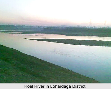
History of Lohardaga District History of Lohardaga District dates back to ancient times. Jain literature refers to Lord Mahavira's visit to a place called 'Lore-a-Yadaga', a term that also appears in Mundari literature. 'Lore-a-Yadaga' in Munda language means river of tears. There is reference of Lohardaga in 'Ain-e-Akbari' as well. The ruins of forts and temples of Korambe, Bhandra, and Khukhra-bhakso, are mute testimony to its rich cultural past. Local historians say that Lohardaga was once a major centre for smelting iron. Historical accounts states that around 1765, the British East India Companyentered this area. In 1833, when 'South West Frontier Agency' was established, the chief agent of the Governor General was the resident in Lohardaga. In 1842, the Principal Assistant to the 'Agent' was relocated from Lohardaga to Ranchi (then known as Kishunpur). In 1843 a Deputy Commissioner was placed and Courts were established at Ranchi but the Commissioner continued to work from Lohardaga until 1899 despite the fact that in 1854 the South West Frontier Agency was abolished. Bihar government notified Lohardaga as a sub division in 1972 and as a district on 17th of May, 1983. Geography of Lohardaga District Lohardaga District is divided into two broad physical divisions namely the Hilly Tract and the Chotanagpur Plateau Region. The hilly tract is extended in the west and northwestern parts of the district, which includes parts of Kisko, Senha and Kuru development blocks. The high hilltops of this region are known as Pat. The region is covered mainly with Sal forests. Further, this region has a number of small hill blocks covered with forests. The general slope of Lohardaga District is from west to east. There are many rivers present in the district. Some of the main rivers are Koel River, Sankh River, Nandini River, and Fulijhar River, etc. These are mainly rain-fed rivers. Some springs are also seen in the hilly tract of the district. Geologically the area comprises Archean Granites and Gneisses. Alluvium is found in the river valleys. The most important mineral that is present in Lohardaga District is bauxite. Other minerals, which are found, are feldspar, fire clay and china clay respectively. These minerals have less economic importance. The major part of the district is covered with golden alluvium, red and sandy and red and gravelly soils. Laterite and red soils are also found elsewhere in Lohardaga District. The district enjoys a healthy and pleasant climate throughout the year. The annual average temperature is 230 centigrade and the district receives an annual average rainfall of 1000-1200 mm. The rainfall increases from west to east as well. Demography of Lohardaga District According to the Population Census in the year 2011, Lohardaga District had population of 461,738 of which male and female were 232,575 and 229,163 respectively. The population of the Lohardaga District constituted 1.40 percent of total population of the Jharkhand. The population density of Lohardaga district for 2011 is 310 people per sq. km. Lohardaga district administers 1,491 square kilometers of areas. The average literacy rate of Lohardaga District in 2011 was 68.29 percent compared to 53.58 of 2001. If things are looked out at gender wise, male and female literacy were 78.62 percent and 57.86 percent respectively. The total literates in Lohardaga District were 263,640 of which male and female were 152,509 and 111,135 respectively. Culture of Lohardaga District Lohardaga District is a big tribal region. The region has been a sort of loose confederation of freely associating concatenation of economically self-sufficient village communities since time immemorial. This confederation of tribespersons extended from south-western Bengal, southern Bihar, large parts of Orissa, northern Andhra Pradesh, southern Madhya Pradesh, Western and coastal Maharashtra respectively. About 59 percent of the total population of the district is tribal population, Oraon tribe is the major tribal inhabitant of the district, and some of the other primitive tribes are Asur tribe, Birjia tribe, etc. All the tribes are still preserving their supplementary old culture in the district. The tribal communities of Lohardaga have a separate and stylish ethnicity based on fine consideration of land, sustainable natural resource management, and also community rights. They always try to enrich them with every possible way. The tribal people depend heavily on forest resources such as stems, tubers, fruits, leaves, flowers, animals, timber, and herbs, for food, shelter as well as medicines. There is a symbiotic relationship between the tribal people and the forest that exceeds purely material and also sometimes deeper metaphysical. This often becomes spiritual also. The sacred grove is called 'Sarna'. Their marriage traditions are also unique and interesting. Economy of Lohardaga District Agriculture is the main source of income in Lohardaga District. There is hardly any source of irrigation because the district covers mostly hilly areas. The means of irrigation in the district are river, canal, ponds and wells. About 90 percent of the total population of the district is dependent on agriculture. The net sown area of the district is 7744.78 hectares out of which, only 7034.20 hectares of land is under irrigation. The main crop of the district is rice followed by millets, maize, pulses, wheat, oilseeds, and groundnuts. There is a total absence of large-scale industries in Lohardaga District. People are engaged in small scale industries only like making of stone chips, bricks, soaps, oil, candles, aluminums goods, wooden furniture, earthen pots, bamboo baskets, weaving of cloths and carpets, etc. The district does not have a good network of communication. There are no national highway passes through the Lohardaga District and Lohardaga town is located on the state highway between Ranchi and Raurkela. Lohardaga is also connected with Ranchi by a metre gauge railway line. |
| |||


Lohardaga District
| Lohardaga District is mainly a tribal district of Jharkhand. Lohardaga District comprises a fine blend of forests, tribes and useful mineral resources. |
| ||||||||||||||||||||||||||||

