 Harda district is one such district in the state of Madhya Pradesh, which is situated in the central part of India. This Harda district forms an integral part of the Bhopal Division. Harda District was created in 6th July 1998, when it was divided from Hoshangabad District.
History of Harda District
Harda District has an old history. Its history dates back to the time of the rule of Mughal dynasty. Harda was one of the larger places in the old `Madhya Prant` and includes area of `Siwni Malwa". Later during British regime, the freedom fighters of Harda fought against British.
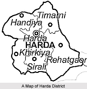
Geography of Harda District
The district is situated 302m higher from the sea level. Its geographical position is in between 21 degrees 53 minutes and 22 degrees 36 minutes east longitude and between 76 degrees 47 minutes and 77 degrees 20 minutes north latitude. The district of Harda covers an area of more than 900 sq. km .On all sides, Harda District is covered by the boundaries. On the northern side, it is surrounded by the districts of Sehore; on the northeastern sides Hoshangabad, Betul District to the southeastern part, Khandwa (East Nimar) District to the southern and western parts, and Dewas District to the northwestern sides cover it. Harda is situated in the `Narmada Rive valleyr `, and the Narmada creates the northern boundary of the Harda district. The land ascends to the Satpura Mountain
Range to the south. In Harda district, there are three main rivers namely the Narmada River, Ganjaal River and the Maachak River. The climate of Harda district is normal. All the seasons come in the district. An average height from the sea level is 302 metres. The district feels maximum temperature up to 47 degrees centigrade and minimum up to 12 degrees centigrade. The district has an average rainfall of 916 millimetres. The tropical dry deciduous forest with teak (Tectona grandis) as a dominant tree species occupies 50 per cent of the area of the Harda Forest Division.
Demography of Harda District
According to the Population Census 2011, Harda District had a population of 570,302. Out of which the males and females were 295,208 and 275,094 respectively. Harda District population constituted 0.79 percent of total population of Madhya Pradesh. The average literacy rate of Harda was 74.04. If things are looked out at gender wise, male and female literacy rate were 83.12 and 64.30 percent respectively.
Tourism in Harda District
There are many tourist spots in Harda. Harda is rich in pilgrimage tourism and nature tourism. Harda is freely connected by road and rail from the state capital, Bhopal and it is about 168 kilometres away from it. It is connected by rail with all major cities of the state. All Three Blocks Headquarters namely Harda, Khirkiya and Timarni are well connected by road and rail.


