 Guna District was the part of Avanti Kingdom founded by Chand Pradyota Mahesena. Later, Shishunaga added the kingdom of Avanti, which included Guna to the growing empire of Magadha.
History of Guna District
In the beginning of 18th century Chanderi was the part of Malwa and the remaining portion of Guna formed the part of Raghogarh State. Later on Raghogarh was split into three state of which Garah and Dharnawada State among the three claimants of Raghogarh family. After Sepoy Mutiny 1857, Guna district thus passed under the control of Gwalior State with Raghogarh as its mandatory chief. After independence on 28th May 1948, Guna became the part of Madhya Bharat as one of its 16 districts. Subsequently as a result of formation of the state of Madhya Pradesh in 1956 Guna district became a part of it.
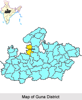
Geography of Guna District
The district is situated between 23 degrees 53 minutes north and 25 degrees 6 minutes north latitude and 76 degrees and 78 degrees east longitude. The western boundary of the District is well defined by the rivers. The Parbati River is the main river flowing along the western boundary touching Rajgarh District of Madhya Pradesh and Jhalawarh and Kota District of Rajasthan. Shivpuri District and Kota are located in north where as Vidisha District, Bhopal and Rajgarh lies to the South. The total area of District is 6484.63 square kilometres with a population of 83, 8926. The main crops produced in the district are rice, sunflower, wheat, sugarcane, oilseeds and maize.
Demography of Guna District
In 2011, Population census report recorded Guna district had population of 1,240,938. Out of which, the male and female were 649,591 and 591,347 respectively. The data released by census India 2011, shows that density of Guna district for 2011 is 194 people per sq. kilometres. The average literacy rate of Guna District in 2011 was 65.10. Out of which, the male and female literacy rate were 76.57 and 52.53 respectively.
Economy of Guna District
Endowed with rich black soil, Guna District is generally known as the granary of region but lately Guna has awakened to the need of industrial and commercial expansion too. Lying mid way between Gwalior in the north and Indore in the South the too big industrial and commercial centres, its situation on the main National Highway add to its potentialities in the sphere of industrialization. Some of the prominent industrial units of Guna District are National Fertilizers Limited, Gas Authority of India Ltd., and Deepak Spinners Ltd. etc.
As per as the connectivity of the District is concerned it can be said that Guna district is well connected with Madhya Pradesh and other parts of India by road, rail and air routes.


